Hurricane Erin UK Weather Forecast - Expert Analysis and Warnings
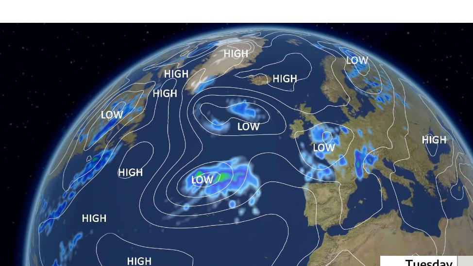
The Hurricane Erin UK Weather Forecast has become a key topic of discussion as meteorologists monitor how Atlantic storm systems may influence conditions across the United Kingdom. Although hurricanes weaken significantly before reaching Europe, their remnants often interact with existing weather fronts, resulting in heavy rainfall, strong winds, and increased flooding risks rather than tropical-style destruction.
This expert-led breakdown explains how Hurricane Erin could affect UK weather, what forecasts currently indicate, and why residents should pay attention to official warnings.
How Hurricane Erin Transitions Before Reaching the UK
Hurricanes form over warm tropical waters, but as they move north-east across the Atlantic, environmental conditions change rapidly. Cooler sea temperatures, stronger upper-level winds, and interaction with mid-latitude systems weaken the storm’s tropical core.
By the time Erin approaches Europe, it typically becomes a post-tropical cyclone, meaning:
-
The storm expands in size
-
Rainfall coverage increases
-
Wind fields become broader but less intense
According to the UK Met Office, remnants of Atlantic hurricanes are linked to nearly one in five high-impact rainfall events affecting the UK during late summer and autumn.
In recent reporting by The London Magazine, weather experts have highlighted that post-tropical systems often produce more widespread disruption than short-lived severe storms because they persist for several days.
Hurricane Erin UK Weather Forecast: What Experts Are Monitoring
The hurricane erin uk weather forecast is primarily focused on rainfall accumulation and ground saturation rather than extreme wind speeds. Forecast models suggest Erin’s remnants may merge with existing low-pressure systems, increasing rainfall intensity across parts of the UK.
Meteorologists are closely monitoring:
-
Moisture levels transported from the Atlantic
-
Jet stream alignment directing rainfall bands
-
River catchments already affected by earlier rain
Current projections indicate some regions could receive 40–80 mm of rain within 48 hours, which is close to the UK’s average monthly rainfall compressed into a short timeframe.
The Role of the Jet Stream in Erin’s Impact
The polar jet stream plays a decisive role in determining how much of Erin’s energy reaches the UK. When former hurricanes are absorbed into this fast-moving air current, their moisture spreads quickly across large areas.
Climate studies show that jet-stream-assisted storms can increase rainfall intensity by 20–30% compared to typical Atlantic lows. This is why Erin’s remnants may still have notable impacts despite losing hurricane status.
Rainfall Patterns and Flood Risk Across the UK
Rainfall is expected to be the dominant feature of Erin’s influence. Prolonged rain, rather than short bursts, poses the greatest flooding risk, particularly in areas with saturated soil.
The Environment Agency notes that flood likelihood increases significantly when rainfall exceeds 30 mm in 24 hours, especially following previous wet spells. Over the past decade, the UK has experienced a 25% increase in heavy rainfall days, intensifying flood vulnerability nationwide.
Hurricane Erin London Flooding Risk
In urban centres, hurricane erin london flooding concerns are largely related to surface water rather than river overflow. London’s dense infrastructure limits natural drainage, meaning intense rainfall can overwhelm systems quickly.
Transport studies indicate that severe rainfall events can disrupt travel for hundreds of thousands of commuters due to road closures and Underground delays, even when rainfall lasts only a few hours.
As storms like Erin approach, understanding how official alerts work becomes increasingly important. The UK Weather Warning System explains how colour-coded alerts for rain, snow, ice, and storms are issued, helping residents assess risk levels and prepare accordingly. This detailed guide outlines how warnings are structured and why they matter during complex weather events.
Wind Impacts: Coastal and Inland Areas
Although Erin is not expected to bring hurricane-force winds, post-tropical systems can still generate disruptive gusts. Coastal areas are particularly exposed, especially when strong winds coincide with high tides.
The Met Office confirms that wind gusts of 45–60 mph can:
-
Down weakened trees
-
Damage temporary structures
-
Disrupt ferry and rail services
Inland regions may see fewer wind impacts, but waterlogged ground increases the risk of trees toppling, leading to power outages and transport delays.
Marine Conditions and Coastal Erosion
Atlantic storm remnants often generate powerful swells well ahead of landfall. Wave-monitoring data shows that post-tropical systems can produce waves exceeding 5 metres, affecting shipping routes and accelerating coastal erosion.
Repeated exposure to such conditions poses long-term challenges for vulnerable UK coastlines, particularly in western and south-western regions.
Forecast Accuracy and Weather Models
Forecasting post-tropical storms is complex due to their evolving structure. Meteorologists rely on advanced global models such as the ECMWF and the UK Met Office’s Unified Model to assess Erin’s trajectory and rainfall distribution.
Forecast confidence improves substantially within 72 hours of impact, once interactions with other weather systems become clearer. Small track shifts, however, can still alter rainfall outcomes significantly.
Climate Trends and Future Implications
Climate research suggests warmer oceans allow storms to retain more moisture for longer periods. The Intergovernmental Panel on Climate Change reports that for every 1°C rise in global temperature, the atmosphere can hold about 7% more moisture.
While hurricanes will not directly strike the UK, storms like Erin are increasingly capable of delivering heavier rainfall, raising long-term flood risks.
Conclusion
The forecast surrounding Hurricane Erin highlights how Atlantic systems continue to shape UK weather patterns. Though Erin will not arrive as a hurricane, its remnants may bring prolonged rainfall, gusty winds, and localized flooding. Staying informed through reliable forecasts and understanding official warnings remains essential as the UK adapts to increasingly complex weather conditions.
Frequently Asked Questions
Can Hurricane Erin reach the UK as a hurricane?
No. Hurricane Erin weakens over cooler Atlantic waters and reaches the UK as a post-tropical system bringing rain and wind rather than hurricane-force conditions.
What is the biggest risk from Hurricane Erin in the UK?
The main risk is heavy rainfall causing surface water and river flooding, especially where ground conditions are already saturated.
Why is London vulnerable to flooding during storms like Erin?
London’s dense urban surfaces reduce drainage, making surface water flooding more likely during intense rainfall events.
How accurate is the hurricane erin uk weather forecast?
Forecast accuracy improves within 72 hours, but rainfall distribution can still shift due to changing storm interactions.
Are storms like Erin becoming more common in the UK?
Heavy rainfall events linked to post-tropical systems are increasing as warmer oceans supply more atmospheric moisture.